Mapping Our Claim: Philippine Maps Have Shown the West Philippine Sea Since 1734

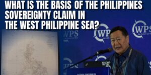
As early as 𝟏𝟕𝟑𝟒, 𝐭𝐡𝐞 𝐌𝐮𝐫𝐢𝐥𝐥𝐨 𝐕𝐞𝐥𝐚𝐫𝐝𝐞 𝐌𝐚𝐩 — the 𝐟𝐢𝐫𝐬𝐭 𝐨𝐟𝐟𝐢𝐜𝐢𝐚𝐥 𝐦𝐚𝐩 𝐨𝐟 𝐭𝐡𝐞 𝐏𝐡𝐢𝐥𝐢𝐩𝐩𝐢𝐧𝐞𝐬 𝐝𝐮𝐫𝐢𝐧𝐠 𝐭𝐡𝐞 𝐒𝐩𝐚𝐧𝐢𝐬𝐡 𝐫𝐞𝐠𝐢𝐦𝐞 — already illustrated the country’s territorial extent with consistent markings. …

No Room for Doubt: Philippines Stands Firm on West Philippine Sea Rights

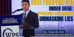
The Philippine government has reaffirmed that its 𝐩𝐨𝐬𝐢𝐭𝐢𝐨𝐧 𝐢𝐧 𝐭𝐡𝐞 𝐖𝐞𝐬𝐭 𝐏𝐡𝐢𝐥𝐢𝐩𝐩𝐢𝐧𝐞 𝐒𝐞𝐚 remains 𝐟𝐢𝐫𝐦, 𝐮𝐧𝐞𝐪𝐮𝐢𝐯𝐨𝐜𝐚𝐥, 𝐚𝐧𝐝 𝐮𝐧𝐝𝐢𝐬𝐩𝐮𝐭𝐞𝐝, 𝐠𝐫𝐨𝐮𝐧𝐝𝐞𝐝 𝐢𝐧 𝐢𝐧𝐭𝐞𝐫𝐧𝐚𝐭𝐢𝐨𝐧𝐚𝐥 𝐥𝐚𝐰. 𝐍𝐚𝐭𝐢𝐨𝐧𝐚𝐥 𝐒𝐞𝐜𝐮𝐫𝐢𝐭𝐲 𝐂𝐨𝐮𝐧𝐜𝐢𝐥 𝐨𝐟 𝐭𝐡𝐞 𝐏𝐡𝐢𝐥𝐢𝐩𝐩𝐢𝐧𝐞𝐬 𝐀𝐝𝐯𝐢𝐬𝐞𝐫 𝐄𝐝𝐮𝐚𝐫𝐝𝐨 …

PCG Underscores Importance of Transparency in West Philippine Sea

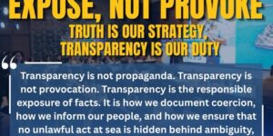
𝐑𝐞𝐚𝐫 𝐀𝐝𝐦𝐢𝐫𝐚𝐥 𝐉𝐚𝐲 𝐓𝐚𝐫𝐫𝐢𝐞𝐥𝐚, underscored the 𝐢𝐦𝐩𝐨𝐫𝐭𝐚𝐧𝐜𝐞 𝐨𝐟 𝐠𝐨𝐯𝐞𝐫𝐧𝐦𝐞𝐧𝐭’𝐬 𝐭𝐫𝐚𝐧𝐬𝐩𝐚𝐫𝐞𝐧𝐜𝐲 in reporting developments in the 𝐖𝐞𝐬𝐭 𝐏𝐡𝐢𝐥𝐢𝐩𝐩𝐢𝐧𝐞 𝐒𝐞𝐚. Rear Admiral Tarriela said 𝐭𝐫𝐚𝐧𝐬𝐩𝐚𝐫𝐞𝐧𝐜𝐲 𝐢𝐬 𝐞𝐬𝐬𝐞𝐧𝐭𝐢𝐚𝐥 𝐭𝐨 𝐜𝐮𝐫𝐛 𝐭𝐡𝐞 𝐬𝐩𝐫𝐞𝐚𝐝 𝐨𝐟 …