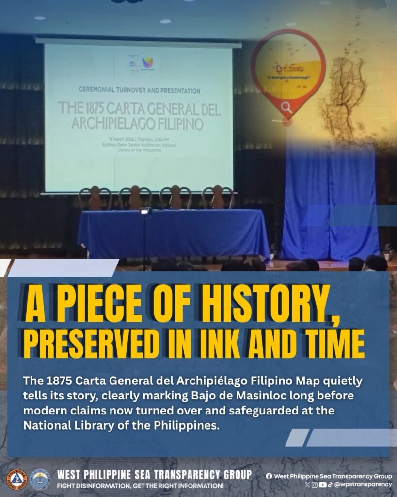
𝐉𝐮𝐬𝐭𝐢𝐜𝐞 𝐀𝐧𝐭𝐨𝐧𝐢𝐨 𝐓. 𝐂𝐚𝐫𝐩𝐢𝐨 formally turned over and presented the 𝟏𝟖𝟕𝟓 𝐂𝐚𝐫𝐭𝐚 𝐆𝐞𝐧𝐞𝐫𝐚𝐥 𝐝𝐞𝐥 𝐀𝐫𝐜𝐡𝐢𝐩𝐢é𝐥𝐚𝐠𝐨 𝐅𝐢𝐥𝐢𝐩𝐢𝐧𝐨 to the 𝐍𝐚𝐭𝐢𝐨𝐧𝐚𝐥 𝐋𝐢𝐛𝐫𝐚𝐫𝐲 𝐨𝐟 𝐭𝐡𝐞 𝐏𝐡𝐢𝐥𝐢𝐩𝐩𝐢𝐧𝐞𝐬 on March 19. He described it as one of the most detailed and comprehensive maps in Philippine history, as it clearly identifies Panacot Island, also known as Bajo de Masinloc or Scarborough Shoal, and includes high-tide features of the islands along with hydrographic details.
In addition to this map, brief overviews of other historical maps were also presented, showing that 𝐁𝐚𝐣𝐨 𝐝𝐞 𝐌𝐚𝐬𝐢𝐧𝐥𝐨𝐜 had long been depicted as part of the Philippines. This historical map serves as strong evidence that even during that period, Bajo de Masinloc, located in the 𝐖𝐞𝐬𝐭 𝐏𝐡𝐢𝐥𝐢𝐩𝐩𝐢𝐧𝐞 𝐒𝐞𝐚 has already been recognized as part of Philippine territory, reinforcing the country’s claims through historical and factual basis.